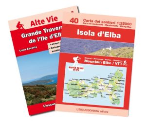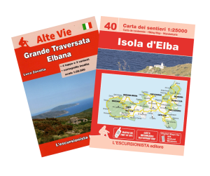


40 - Isola d'Elba map (Elba Island) hiking map 1:25.000 ENGLISH


Hiking map of Elba Island with Great Elban Traverse booklet attached.

Spesa minima per la spedizione gratuita: 50,00 €
NOTA: Valido solo per spedizioni in Italia
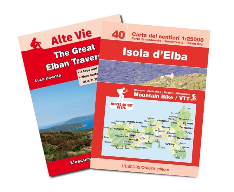
Centers: Portoferraio, Marina di Campo, Rio nell'Elba, Capoliveri
• Edition: Second
• Year: May 2018
• Format: 12x17 (guidebook) - 90x100 (map)
• Pages: 36 guidebook + map 1:25.000
• Photos: Colour
• Binding: Stapled
• ISBN: 9788898520435
• Code: ESC40I
Isola d'Elba's hiking and MTB map at a 1:25.000 scale with a WGS84 grid (1km). All data has been gathered by walking each route with a GPS device. 32 page guide-book which includes The Great Elban Traverse The Great Elban Traverse trek follows a mountain ridge high above the crystal clear blue sea and the scents of the Mediterranean maquis, in the heart of the Parco Nazionale dell'Arcipelago Toscano. Four stages explore the backbone of the island from north-east to west, from Cavo all the way to Patresi or Pomonte, with overnight stays in lovely villages where the local cuisine can be enjoyed. Elba was Napoleon's island for a short but significant period. A number of variants are given so that walkers can modify the route according to personal needs, and full details are provided for preparing the trek.
| SKU | ESC40I |
|---|---|
| Autore | Zavatta L. |
| Editore | L'ESCURSIONISTA EDITORE |
| Collana | CARTE DELL'ESCURSIONISTA |
| Scala | 1:25.000 |
| Lingue Guida/Cartoguida | Inglese |
| Lingue Cartina | Italiano, Inglese, Francese, Tedesco |
| Anno | 2018 |
| Stati | Italia |
| Regioni Italia | Toscana |
Peso
Spedizione con corriere in max 48 ore.
Qualora l'imballo evidenzi danni / manomissioni NON accettare la merce